


Brendon Quirk is a doctoral student in the Geology and Geophysics Department here at the University of Utah. He has dedicated countless hours to the search for evidence that indicates historic glaciers along the Wasatch Front. These historic ice sheets have been coined by Quirk and journalist Paul Gabrielsen as the “Glacial Ghosts”.
What exactly makes a glacier? Glaciers are sheets of ice that form high in the mountains through the accumulation and compression of snow. As a result of their massive weight, glaciers slowly move downhill.
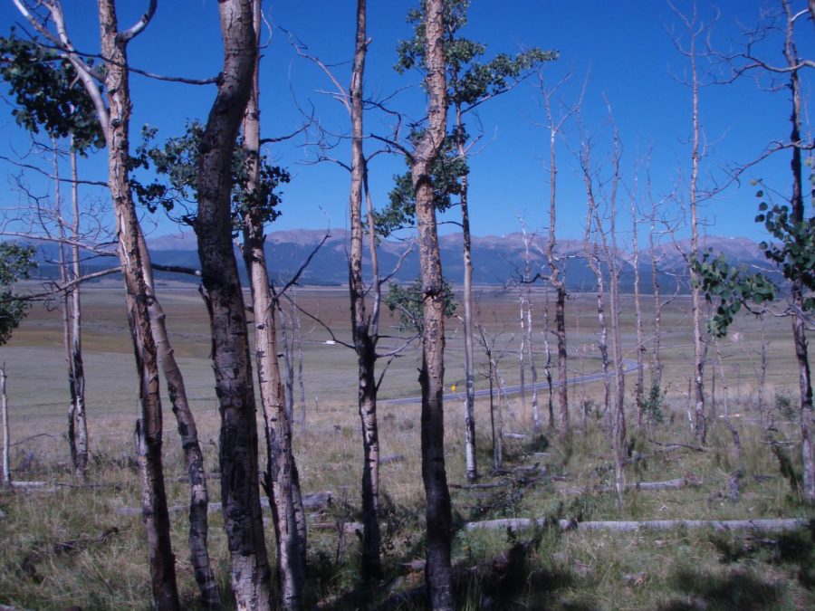
As glaciers travel, they scour the earth that they travel on, picking up chunks of rock and soil that they later deposit elsewhere. The ice and rocks that they contain dig into bedrock to create formations known as striations. These deep scratches preserved in the hard bedrock can indicate the direction that a glacier was traveling. Ridges of earth left behind the edges of glaciers are commonly known as moraines. These are another hint to the paths of long-gone glaciers.
Moraines mark the farthest point of glacial travel in any direction. They serve as evidence that even when a glacier is melting, it still delivers sediments down the canyon due to water runoff. This runoff sometimes carries remaining rocks, known as erratics. Unlike any local sedimentary bedrock found in their immediate vicinity, erratics are carried and displaced miles from their parent bedrock. Erratics help to provide evidence of glacial flow lines according to the Illinois State Geological Survey.
Big Cottonwood Canyon is considered by some to be one of the best places along the Wasatch front for outdoor sports of all kinds. Just a short 20-minute drive from the U, the canyon offers a multitude of activities from hiking and biking trails to ski resorts and climbing sites. In the spring and summer months, individuals can enjoy wildflower-filled meadows that sprawl across the upper portions of the canyon-like Van Gogh brush strokes or wander through the bowls and basins that shelter isolated high alpine lakes and tributaries. In the fall, the hillsides are ablaze in vibrant oranges, reds and yellows, and biking and climbing increase in popularity as the days become cooler. Once winter strikes and the snow flies, the lines at the entrance of the canyon increase as individuals from all over the world flock to Utah to enjoy our renowned snow and ski resorts.
As you drive along the road towards the ski resorts of Brighton and Solitude, you may happen to notice boulders that look out of place at the top of the cabin. Some are located high on the hills above the roadside, while others are located in the middle of the meadows with no evidence as to how they got there. These seemingly random boulders are popular, especially for rock climbers looking for technical sends that challenge athletes of all skill levels. For Quirk, the term “technical” is applied to rocks in a different sense, to the hidden stories and history behind each boulder.
Those boulders, erratics, are evidence of ancient glaciers. According to the Utah Geological Survey, the Cottonwood Canyons held sizable glaciers between 10,000 and 30,000 years ago. This helps explain why Big Cottonwood Canyon may contain some of the most impressive glacially-caused scenery along the Wasatch Range.
Research has shown that Big Cottonwood’s glaciers did not travel all the way to the Salt Lake Valley. This resulted in the narrow winding canyon entrance (caused by stream erosion) that ends in a wide upper U-shaped canyon. As one drives up the canyon around the ninth mile, the canyon suddenly widens and becomes visibly straighter. The central glacier that carved the upper canyon likely ranged from an average depth of 500 to 800 feet and a length of about five miles.
Recently published in the Geological Society of America Bulletin, the article “Termination II, Last Glacial Maximum, and Lateglacial chronologies and paleoclimate from Big Cottonwood Canyon, Wasatch Mountains, Utah,” written by Quirk and his colleagues explains how his group utilized advanced energy-mass balance and ice-flow models in their search to help identify glacial evidence that will help them understand the prehistoric climate of Utah.
The geologists have made use of advanced techniques that provide more in-depth information regarding glacial evidence. LiDAR, Light Detection and Ranging, is a laser-based radar system that helps to create detailed terrain maps by removing signs of vegetation. The National Oceanic and Atmospheric Administration under the U.S. Department of Commerce, describes this advanced technology as a remote sensing method that uses light in the form of a pulsed laser to measure variable distances, producing a 3D image of surface characteristics.
In an interview with Paul Gabrielsen, Quirk said, “We can, from our office, very quickly map areas of interest that might have small moraines in them. So we’re finding these small moraines that had previously gone unnoticed. If you don’t know where to look you could spend a lot of time covering a lot of ground looking for these features.”
In addition to LiDAR, cosmogenic dating has also been used by Quirk’s team in their search efforts. Cosmogenic isotopes are made when atmospheric elements are subjected to high energy particles known as cosmic rays. The accumulation of these isotopes in the surface of rocks can help to identify the age of the exposed rock. Through their findings, the group has been able to support their hypothesis of a relatively cold and arid climate in the Great Basin region that was followed by a period of increased rain and warming temperatures. The transition of climate is believed to have begun about 19,000 years ago with the ending of the Last Glacial Maximum. As the weather warmed, the ancient glaciers began to recede. Their water formed flowing rivers that emptied out into the great Lake Bonneville, carving out the lower canyon that we know today.
The next time you go on a canyon drive and see the odd scratches in the bedrock or the giant stranded boulders that seem to litter the upper meadows of the ski resorts and basins, you will know that 19,000 years ago, a giant sheet of moving ice picked them up and rearranged the landscape. Now, all that’s left is their ghostly reminder.
During his interview with Gabrielsen, Quirk was asked about locations in Big Cottonwood Canyon where one could see glacial evidence. For all those interested in viewing these formations, here are the coordinates:
40. 60628 N, 111.69677 W
“The one that people are most familiar with is up at Lake Blanche,” Quirk said. “The softer shale and siltstones have deep prominent glacial striations cut into them at the base at the rim of Lake Blanche.” Quirk collected rock samples around Lake Blanche to date the disappearance of glaciers there around 15,000 years ago.
40.62446 N, 111.74535 W
“You can see similar glacial polish up near the Storm Mountain picnic area,” Quirk said, just above the stairs power plant. “If you follow the trail that climbers use to come down near the water pipe you go to the top of a bedrock knob and you can see polished smooth Big Cottonwood quartzite with striations. You can put your hand on a surface where a glacier was from the penultimate glaciation.”
40.61586, 111.58981 W
“As you’re driving up near the Redman Campground by Solitude, if you go walking you can see ridges throughout that campground,” Quirk said. “Those are actually moraines that we dated up there so we know that ice abandoned that position at that campground 15,000 years ago.”
40.63207 N, 111.72597 W
Hikers on the Broads Fork Trail will also encounter moraines, walking along the level ridge of a moraine just above the trail’s initial switchback ascent. “We sampled boulders just off the trail there,” Quirk says. “You’re walking along a lateral moraine from a glacier that abandoned that position 20,000 years ago.”
40. 63377 N, 111.72363 W
Striated quartzite bedrock just above the Lake Blanche trailhead parking lot has an age of 18,000 years. “This shows that while the glacier there abandoned the higher elevation moraine 20,000 years ago it didn’t retreat from the lower elevation bedrock until 18,000 years ago,” Quirk said. “So, in fact, we know the glacier was thinning from 20,000 to 18,000 years ago and only then retreating uphill.”